3T - Explorando el Centro de servicios de mapas de FEMA
En vigor desde el 19 de abril 2005 los Mapas de Inundación de FEMA, (FIRM, significa “Flood Insurance Rate Maps”), se convirtió en el único documento oficial para la determinación de zonas de inundación para ser utilizado por las agencias federales, estatales y municipales. Los mapas de la Junta de Planificación de Puerto Rico Planificación ya no están disponibles. Los Mapas de Puerto Rico se actualizaron el 18 de noviembre del 2009. Los Mapas impresos ya no son publicados.
Horas Contacto: Tres (3) horas técnicas
Descripción:
En vigor desde el 19 de abril 2005, los Mapas de Inundación de FEMA (FIRM – “Flood Insurance Rate Maps”) constituyen el único documento oficial para la determinación de zonas de inundación que utilizan las agencias federales, estatales y municipales. Los mapas de la Junta de Planificación de Puerto Rico ya no están disponibles. Los Mapas de Puerto Rico se actualizaron el 18 de noviembre de 2009, y los impresos ya no se publican. Todos los productos de riesgo de inundación ahora están disponibles de forma gratuita, y el catálogo de productos anteriores fue reemplazado con un sistema integrado de búsqueda.
En este curso discutiremos todas las características que le permitan encontrar y descargar los productos para un área geográfica. Se ofrecerá, además, una visión general sobre el trasfondo de los recursos y su disponibilidad. También se proveerá un resumen sobre los cambios en la forma de maximizar el uso de los nuevos recursos.
Este curso abarca los siguientes temas:
- Antecedentes históricos
- ¿Qué es una empresa y qué hay nuevo?
- MSC Buscar
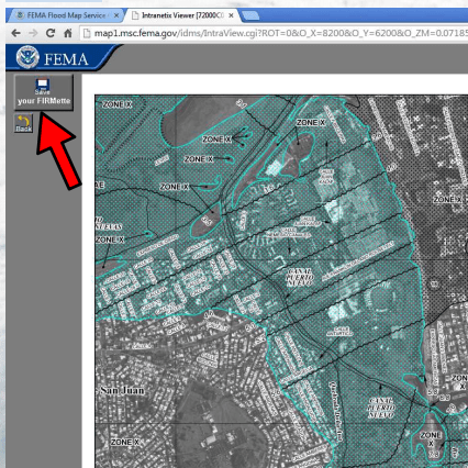
- Ver FIRM
- Cómo hacer un FIRMette línea
- Descarga FIRM para aplicaciones CAD y GIS
- Productos y Herramientas de MSC
- Cómo hacer una línea FIRMette
- GEOPLATFORM de FEMA
- Datos de Inundaciones en Google Earth
- MSC: Cómo leer un mapa de inundación
- Aplicaciones Varios
- Otros sitios para obtener datos de inundación
Horas Contacto: Tres (3) horas técnicas
Instructor: Alexis Ocasio Agosto – Agrimensor, Ingeniero Civil, PLS, EIT, GISP, CDT
| Learning Objectives | Este curso abarca los siguientes temas:
|
|---|---|
| Contact Hours | 3 Horas |
| CIAPR courses | CURSO TECHNICO |
| Instructor | Alexis Ocasio Agosto, Agrimensor, Ingeniero Civil, PLS, EIT, GISP, CDT |
| Devices | Desktop, Tablet, Mobile |
| Language | Español |
IACET ACCREDITED PROVIDER
|
|
Self Learning Solutions LLC is a company with more than 14 years of experience in this market. At Self Learning Solutions we are proud to have obtained the IACET accreditation for our organization, along with the approvals necessary to market our products throughout the United States. Self Learning Solutions is accredited by the International Association for Continuing Education and Training (IACET). Self Learning Solutions complies with the ANSI / IACET standard, which is recognized internationally as a standard of excellence in instructional practices. As a result of this accreditation, Self Learning Solutions is accredited to issue the CEU IACET. |
SLSTECH System Requirements
To run our system effectively you should, as a minimum, use the system components listed on this page. If you do not, the system may still work but some functionality may be lost. Workplace IT environments' internal configurations can also restrict the functionality of our system. Access to content may be affected, as may the possibility of uploading files. File size limitations may also apply. Workplaces may also have older versions of software, and our system may not perform well with these.
Operating system
-
Recommended: Windows 7, 10, Mac OSX Sierra, iPad IOS10
Internet speed
-
Use a broadband connection (256 Kbit/sec or faster—this will ensure that you can view videos and online presentations) through USB wireless modem, ADSL, T1/T2, fibre optic or cable.
-
Dial-up access will be significantly slower, and we do not recommend it for using our system.
Internet browsers
Compatible browsers include:
-
Google Chrome 32 bit version 50 or later (recommended for optimal compatibility, this has been thoroughly tested on Windows)
Safari 10 or later (recommended for optimal compatibility, this has been thoroughly tested on Mac)
Note that add-ons and toolbars can affect any browser's performance.
-
MS Internet Explorer is not recommended
Settings
We recommend that the following be enabled:
-
Cookies
-
Pop-ups (in both Internet browser and security software)
-
Javascript
-
We recommend that you use the latest version of Adobe Flash Player.
Software
-
We recommend that you use the latest version of Adobe Acrobat Reader.
-
To view all the resources uploaded to Hazmat Authority, you will probably need to have Microsoft Office (Word, Excel, PowerPoint) or an equivalent (e.g. Open Office, Viewer) installed.
Security
With all firewalls, ensure that you enable uploading of files.


Validate your login
Sign In
Create New Account